| Journal | Sustainability | Section: Geography and Sustainability | |
| Special Issue Title: | Applications of GIS and Remote Sensing for Sustainable Spatial Planning | ||
| Submission Deadline: | 15 April 2023 | ||
| Part-1: Guest Editor(s) | |||
| Leading Guest Editors | Title: | Dr. | |
| Name: | Lia Bárbara Cunha Barata Duarte | ||
| Email: | liaduarte@fc.up.pt | ||
| Affiliation: | Faculty of Sciences, University of Porto, 4169-007 Porto, Portugal; Institute of Earth Sciences, University of Porto, 4169-007 Porto, Portugal | ||
| Homepage: | https://www.i-c-t.pt/g3/index.php/liaduarte/ | ||
| Research Interests: | GIS; GIS open source applications; spatial management; land use planning; spatial analysis | ||
| Photo |  |
||
| Co-Guest Editors
(1–3 Assistant Guest Editors; you may invite your colleagues who are interested in this proposal.) |
Title: | Prof. Dr. | |
| Name: | Ana Cláudia Moreira Teodoro | ||
| Email: | amteodor@fc.up.pt | ||
| Affiliation: | Faculty of Sciences, University of Porto, 4169-007 Porto, Portugal; Institute of Earth Sciences, University of Porto, 4169-007 Porto, Portugal | ||
| Homepage: | https://www.fc.up.pt/RS-GISLab/ | ||
| Research Interests: | remote sensing; image processing; environmental applications; geologic applications; GIS | ||
| Photo |  |
||
| Co-Guest Editors
(1–3 Assistant Guest Editors; you may invite your colleagues who are interested in this proposal.) |
Title: | Prof. Dr. | |
| Name: | Beniamino Murgante | ||
| Email: | beniamino.murgante@unibas.it | ||
| Affiliation: | School of Engineering, University of Basilicata
10, Viale dell’Ateneo Lucano 85100 – Potenza – Italy |
||
| Homepage: | http://service.unibas.it/utenti/murgante/Benny.html | ||
| Research Interests: | spatial planning; spatial simulation; geodemographics; urban modeling; geocomputation; urban simulation models; planning environmental studies on climate change | ||
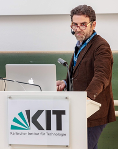
| Photo |  |
||
| Part-2: Special Issue Proposal | |||
| Summary
(200-400 words) |
Dear Colleagues,
The study of sustainable development in any area depends on the knowledge about resource management and hazards in that area. Remote Sensing (RS) technology has enhanced significantly in terms of data acquisition time, sensor resolution, and accessibility over the past several years, with for instance, the emerging of the Google Earth Engine platform. This technology has also been widely applied to address challenges in sustainability. Geographical Information Systems (GIS) also provide essential tools for implementing sustainable processes at different scales. In recent years, GIS technologies combined with satellite RS data have emerged as relevant geospatial tools for the sustainable monitoring and management of natural resources on Earth, providing the support with a focus on natural resource management and assessment of natural hazards. This Special Issue of Sustainability will address the implementation and use of GIS combined with RS data/techniques for sustainable management using geospatial analysis in several areas such as climate change, environment, geology, agriculture, forestry, ecology, coastal ecosystems, among others. It provides a platform for researchers which aimed to publish high-quality original research papers and reviews that focus on sustainable environment.
In this Special Issue, original research articles and reviews are welcome. Research areas may include (but not limited to) the following:
· Spatial planning systems · Urban planning · Spatial analysis and modelling of natural hazards · Environmental management · Spatial and landscape planning · Sustainable planning · Ecosystem Services Analyses · Performance Based Planning
We look forward to receiving your contributions.
Prof. Dr. Lia Duarte Prof. Dr. Ana Cláudia Teodoro Prof. Dr. Beniamino Murgante Guest Editors |
||
| Keywords: | GIS; remote sensing; environmental sustainability; sustainable planning | ||


